
Weigh Station Information
Weigh Stations

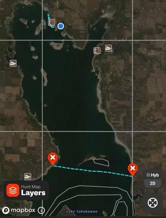
The approximate weigh station locations are marked with an X on the map. Please keep in mind the weigh boats may move to a sheltered location near the marked spot if the weather/wind requires them to do so (for example, NW wind may cause them to move to the east side of the island, etc.).
N Fox Island - 2 locations
Pike Bay - 2 locations
Horsehead Island
Final Weigh Station: Low Water "Sand Spit/Boat Ramp" East of Ramp
Boundaries
The South Boundary is marked with a flag on the west side and a buoy on the east side. The boundary line is approximately 500 yards south of Shell Island as shown in the attached photo.
West Boundary Coordinates: 47*48'17.6"N 102*15'26.3"W
East Boundary Coordinates: 47*48'56.2"N 102*22'13.6"W